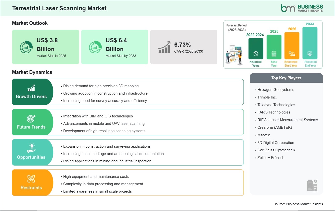
The Terrestrial Laser Scanning Market size is expected to reach US$ 6.4 billion by 2033 from US$ 3.8 billion in 2025. The market is estimated to record a CAGR of 6.73% from 2026 to 2033.
Executive Summary and Global Market Analysis:
The worldwide terrestrial laser scanning (TLS) industry is growing quickly because many sectors want more accurate, detailed 3D mapping/measurement methods for surveying, construction, coal mining, and inspecting structures. With TLS systems’ accurate point clouds, customers can conduct in-depth spatial analyses, model buildings/structures digitally, and virtually rebuild the physical world around us.
Changes in technology, such as mobile scanners, faster scanning speeds and better data processing algorithms, are helping improve productivity within both field operations and post-processing workflows. TLS is also being used in combination with other technologies (e.g., Building Information Modeling (BIM), Geographic Information System (GIS) software, and aerial photography via drones) so customers can better manage their buildings/projects from overall planning to ongoing management and monitoring activities. In addition to longer and heavier scanners, smaller and lighter scanners have made it possible for organizations working in remote locations (like underground mines), historical sites, or dense urban areas to perform TLS scans that were previously impossible due to size/weight limitations of the equipment.
Furthermore, the addition of automated registering as well as AI-assisted data interpretation has decreased the amount of manual work required to register and analyze large collections of point cloud data, thus increasing efficiency and productivity while decreasing the number of compilation errors. Even though the TLS was driven largely by the desire for increased accuracy in survey construction and reducing risk, the market also experiences significant challenges due to the high upfront cost of purchasing equipment, storage constraints (due to big data), and the ongoing requirement to have qualified personnel capable of operating it and interpreting complex data sets produced from point clouds.
To summarize, the TLS is an industry that consists primarily of innovations in growth, across many industries, and where a growing reliance will be on high-fidelity spatial data to derive operational planning.
Key segments that contributed to the derivation of the terrestrial laser scanning market analysis are type, solution, laser type, products, principles, mappings, application, and end use.
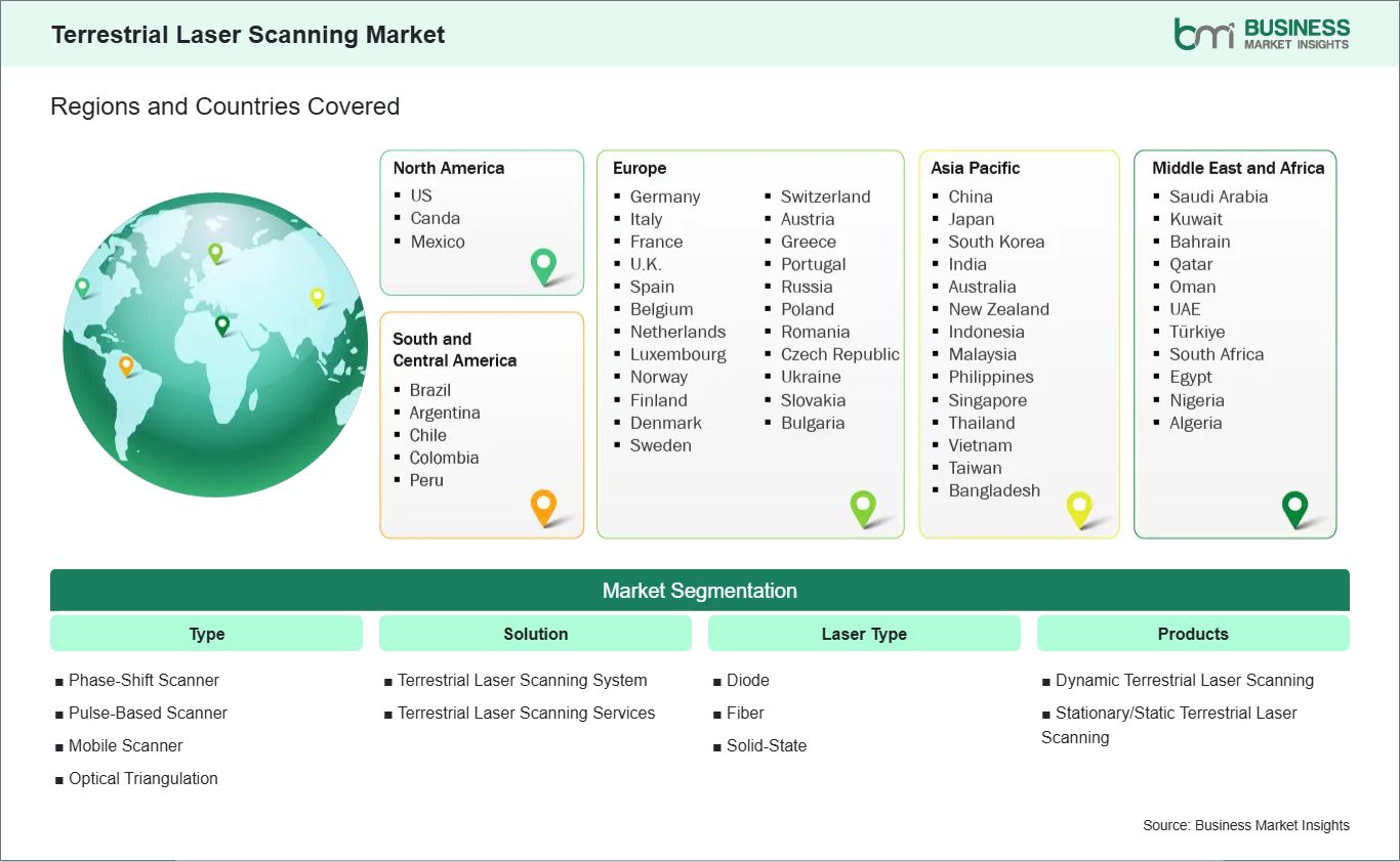
Type, the terrestrial laser scanning market is segmented into phase‑shift scanner, pulse‑based scanner, mobile scanner, and optical triangulation. The phase‑shift scanner segment dominated the market in 2025.
Solution, the terrestrial laser scanning market is categorized into terrestrial laser scanning system and terrestrial laser scanning services. The terrestrial laser scanning system segment dominated the market in 2025.
Laser Type, the terrestrial laser scanning market is classified into diode, fiber, and solid‑state. The diode segment dominated the market in 2025.
Products, the terrestrial laser scanning market is segmented into dynamic terrestrial laser scanning and stationery/static terrestrial laser scanning. The stationary/static terrestrial laser scanning segment dominated the market in 2025.
Principles, the market is categorized into galvanometer scanner, polygonal scanner, shaft scanner, and others. The galvanometer scanner segment dominated the market in 2025.
Mappings, the market is segmented into camera scanner, hybrid scanner, panorama scanner, and others. The panorama scanner segment dominated the market in 2025.
Application, the market is classified into building information modeling (BIM), surveying, research and engineering, and others. The BIM segment dominated the market in 2025.
End Use, the market is segmented into industrial, nuclear sites, power and energy, residential, oil and gas, naval industry, and chemicals. The industrial segment dominated the market in 2025.
Terrestrial Laser Scanning Market Drivers and Opportunities:
Rising demand for high‑precision 3D mapping
The global terrestrial laser scanning (TLS) market is being driven by the rising demand for high‑precision 3D mapping across multiple industries. TLS provides rapid, accurate, and detailed measurements of physical environments, enabling precise modeling of buildings, terrain, and infrastructure. Organizations are increasingly using this technology to reduce errors, improve planning, and enhance decision-making in engineering, construction, and geospatial projects. Advancements in laser scanning systems, including higher resolution, longer range, and faster data acquisition, have expanded their applicability.
Professionals can capture millions of points within minutes, producing dense point clouds that integrate seamlessly with 3D modeling and BIM (Building Information Modeling) software. This has significantly improved project visualization, design verification, and risk assessment. The growing need for accurate and comprehensive mapping in applications such as digital twins, heritage preservation, and industrial modeling is fueling TLS adoption. As industries continue to emphasize efficiency, precision, and safety, high‑performance laser scanning systems are becoming essential tools for global operations.
Expansion in construction and surveying applications
The construction and surveying sectors are major contributors to the global growth of the TLS market. TLS systems are widely used for as-built verification, progress monitoring, and clash detection on complex construction projects. Accurate 3D scans reduce rework, improve collaboration between stakeholders, and support faster, data-driven decision-making throughout project lifecycles. In surveying, TLS enables detailed topographic mapping, volume calculations, and infrastructure assessment with minimal field time. The technology improves operational efficiency, enhances safety by reducing the need for manual measurements in hazardous environments, and delivers high-resolution data for analysis and reporting.
Additionally, the expansion of industrial projects, infrastructure development, and urban planning has increased reliance on TLS for accurate site characterization and monitoring. By enabling faster, more precise, and safer data capture, terrestrial laser scanning has become a critical tool across global construction and surveying workflows, driving widespread adoption across multiple sectors.
Terrestrial Laser Scanning Market Size and Share Analysis:
The Terrestrial Laser Scanning Market demonstrates steady growth, with size and share analysis highlighting evolving trends and competitive dynamics among key players. The report examines subsegments categorized within type, solution, laser type, products, principles, mappings, application, and end use, offering insights into their contribution to overall market performance.
By Type, the phase‑shift scanner subsegment dominated the market in 2025, driven by its high accuracy and efficiency for large-scale surveying and modeling applications.
Based on Solution, the terrestrial laser scanning System subsegment dominated the market in 2025, owing to its wide adoption for industrial, construction, and infrastructure projects.
On the Basis of Laser Type, the diode subsegment dominated the market in 2025, propelled by its precision, lower power consumption, and cost-effectiveness.
In terms of Products, the stationary/static terrestrial laser Scanning subsegment dominated the market in 2025, driven by its stability and suitability for detailed structural scanning.
By Principles, the galvanometer scanner subsegment dominated the market in 2025, owing to its fast-scanning capabilities and reliability.
Based on Mappings, the panorama scanner subsegment dominated the market in 2025, due to its ability to capture comprehensive 3D imaging efficiently.
On the Basis of Application, the BIM (Building Information Modeling) subsegment dominated the market in 2025, driven by the growing adoption of 3D modeling in construction, architecture, and infrastructure planning.
In terms of End Use, the industrial subsegment dominated the market in 2025, propelled by the adoption of laser scanning in manufacturing, plant maintenance, and industrial monitoring applications.
Australia, China, India, Japan, South Korea, Indonesia, Malaysia, Philippines, Singapore, Thailand, Vietnam, Bangladesh, New Zealand, Taiwan
South and Central America
Brazil, Argentina, Peru, Chile, Colombia
Middle East and Africa
Bahrain, Kuwait, Oman, Qatar, Saudi Arabia, United Arab Emirates, Turkiye, South Africa, Egypt, Algeria, Nigeria
Market leaders and key company profiles
Hexagon Geosystems
Trimble Inc.
Teledyne Technologies
Faro Technologies
Riegl Laser Measurement Systems
Creaform (Ametek)
Maptek
3D Digital Corporation
Carl Zeiss Optotechnik
Zoller + Fröhlich
Get more information on this report
Terrestrial Laser Scanning Market Report Coverage and Deliverables:
The "Terrestrial Laser Scanning Market Size and Forecast (2022 - 2033)" report provides a detailed analysis of the market covering below areas:
Terrestrial Laser Scanning Market size and forecast at global, regional, and country levels for all the key market segments covered under the scope
Terrestrial Laser Scanning Market trends, as well as drivers, restraints, and opportunities
Terrestrial Laser Scanning Market analysis covering key trends, global and regional framework, major players, regulations, and recent developments
Industry landscape and competition analysis covering market concentration, heat map analysis, prominent players, and recent developments for the Terrestrial Laser Scanning Market
Detailed company profiles, including SWOT analysis
The geographical scope of the Terrestrial Laser Scanning Market report is divided into North America, Asia Pacific, Europe, Middle East & Africa, and South & Central America. North America held the largest share in 2025.
Regional trends in terrestrial laser scanning adoption reflect differences in industrial infrastructure, technological readiness, and sector-specific demands.
North America leads in TLS adoption due to advanced construction, mining, and infrastructure monitoring applications, with emphasis on integration with BIM workflows and smart city planning.
Europe demonstrates strong usage in heritage preservation, industrial automation, and urban planning, leveraging high-resolution TLS for structural assessment and compliance with strict regulatory standards.
Asia Pacific is witnessing rapid growth, driven by large-scale infrastructure projects, mining expansion, and industrial modernization; mobile and cloud-enabled TLS solutions are increasingly deployed to optimize project timelines and reduce operational risks.
Middle East & Africa is gradually adopting TLS for oil and gas facility monitoring, mining operations, and large-scale construction, where harsh environmental conditions require durable and portable scanning systems. South & Central America is expanding usage in civil engineering, transportation projects, and resource exploration, often focusing on cost-effective TLS solutions adaptable to varying terrain and infrastructure conditions. Across all regions, the market is shaped by factors such as project complexity, investment in digital infrastructure, availability of skilled operators, and the need for precise spatial data, highlighting TLS as a strategic technology for enhancing accuracy, efficiency, and risk management in engineering and surveying operations globally.
Get more information on this report
Terrestrial Laser Scanning Market Research Report Guidance:
The report includes qualitative and quantitative data in the terrestrial laser scanning market within type, solution, laser type, products, principles, mappings, application, end use.
The report starts with the key takeaways (chapter 2), highlighting key trends and outlook of the Terrestrial Laser Scanning Market.
Chapter 3 focuses on the research methodology of the study.
Chapter 4 includes ecosystem analysis.
Chapter 5 highlights the major industry dynamics in the terrestrial laser scanning market, including factors that are driving the market, prevailing deterrents, potential opportunities, as well as future trends. Impact analysis of these drivers and restraints is also covered in this section.
Chapter 6 discusses the terrestrial laser scanning market scenario, in terms of historical market revenues, and forecast till the year 2033.
Chapters 7 to 15 cover terrestrial laser scanning market segments across type, solution, laser type, products, principles, mappings, application, end use and geography across North America, Asia Pacific, Europe, the Middle East & Africa, and South & Central America. They cover the market revenue forecast and factors driving the market.
Chapter 16 describes the competitive analysis along with the heat map analysis for the key players operating in the market.
Chapter 17 describes the industry landscape analysis. It provides detailed descriptions of business activities such as market initiatives, new developments, mergers, and joint ventures globally, along with a competitive landscape.
Chapter 18 provides detailed profiles of the major companies operating in the Terrestrial Laser Scanning Market. Companies have been profiled on the basis of their key facts, business descriptions, products, financial overview, SWOT analysis, and key developments.
Chapter 19, i.e., the appendix, is inclusive of a brief overview of the company, a list of abbreviations, and a disclaimer.
Terrestrial Laser Scanning Market News and Key Development:
The Terrestrial Laser Scanning Market is evaluated by gathering qualitative and quantitative data post primary and secondary research, which includes important corporate publications, association data, and databases. A few of the key developments in the spatial light Modulator market are:
In September 2024, Leica Geosystems (part of Hexagon) announced that it had strengthened its partnership with Boston Dynamics by making the Leica BLK ARC the first certified reality capture device available for integration with Boston Dynamics’ Spot robot, enabling autonomous mobile terrestrial laser scanning missions and expanding automated 3D data capture workflows across industrial and built environments.
In October 2024, FARO Technologies, Inc. announced that it had launched the next generation of its FARO Focus 3D laser scanner portfolio including the new Focus Premium Max featuring expanded scanning range up to 400 m and enhanced Hybrid Reality Capture™ workflow capabilities for more efficient data capture and processing on large‑scale projects.
Key Sources Referred:
International Electrotechnical CommissionInstitute of Electrical and Electronics EngineersInternational Organization for StandardizationBureau of Indian StandardsCentral Electricity AuthorityMinistry of PowerIndian Electrical and Electronics Manufacturers' AssociationEuropean Committee for Electrotechnical StandardizationVDE Association for Electrical Electronic & Information TechnologiesCompany WebsitesCompany Annual ReportsCompany Investor Presentation
The List of Companies - Terrestrial Laser Scanning Market
Hexagon Geosystems
Trimble Inc.
Teledyne Technologies
Faro Technologies
Riegl Laser Measurement Systems
Creaform (Ametek)
Maptek
3D Digital Corporation
Carl Zeiss Optotechnik
Zoller + Fröhlich
About Author— Electronics and Semiconductor Research Team
Siddhika is an experienced market research professional with over five years of expertise in delivering actionable market intelligence and strategic insights to support business growth and decision-making. She has strong experience in designing and managing end-to-end research engagements, including research planning, data collection, and insight generation.
Proficient in research methodologies, Siddhika synthesizes diverse information sources to deliver accurate, high-quality insights and strategic recommendations. She excels at translating complex market information into strategic narratives that support executive decision-making..
Show More
Frequently Asked Questions
How big is the Terrestrial Laser Scanning Market?
The Terrestrial Laser Scanning Market is valued at US$ 3.8 Billion in 2025, it is projected to reach US$ 6.4 Billion by 2033.
What is the CAGR for Terrestrial Laser Scanning Market by (2026 - 2033)?
As per our report Terrestrial Laser Scanning Market, the market size is valued at US$ 3.8 Billion in 2025, projecting it to reach US$ 6.4 Billion by 2033. This translates to a CAGR of approximately 6.73% during the forecast period.
What segments are covered in this report?
The Terrestrial Laser Scanning Market report typically cover these key segments-
Type (Phase-Shift Scanner, Pulse-Based Scanner, Mobile Scanner, Optical Triangulation)
What is the historic period, base year, and forecast period taken for Terrestrial Laser Scanning Market?
The historic period, base year, and forecast period can vary slightly depending on the specific market research report. However, for the Terrestrial Laser Scanning Market report:
Historic Period : 2022-2024
Base Year : 2025
Forecast Period : 2026-2033
Who are the major players in Terrestrial Laser Scanning Market?
The Terrestrial Laser Scanning Market is populated by several key players, each contributing to its growth and innovation. Some of the major players include:
HexagonÃÂ Geosystems
TrimbleÃÂ Inc.
TeledyneÃÂ Technologies
FaroÃÂ Technologies
RieglÃÂ LaserÃÂ MeasurementÃÂ Systems
CreaformÃÂ (Ametek)
Maptek
3DÃÂ DigitalÃÂ Corporation
CarlÃÂ ZeissÃÂ Optotechnik
Zollerà+àFröhlich
Who should buy this report?
The Terrestrial Laser Scanning Market report is valuable for diverse stakeholders, including:
Investors: Provides insights for investment decisions pertaining to market growth, companies, or industry insights. Helps assess market attractiveness and potential returns.
Industry Players: Offers competitive intelligence, market sizing, and trend analysis to inform strategic planning, product development, and sales strategies.
Suppliers and Manufacturers: Helps understand market demand for components, materials, and services related to concerned industry.
Researchers and Consultants: Provides data and analysis for academic research, consulting projects, and market studies.
Financial Institutions: Helps assess risks and opportunities associated with financing or investing in the concerned market.
Essentially, anyone involved in or considering involvement in the Terrestrial Laser Scanning Market value chain can benefit from the information contained in a comprehensive market report.


 Get Free Sample For Terrestrial Laser Scanning Market