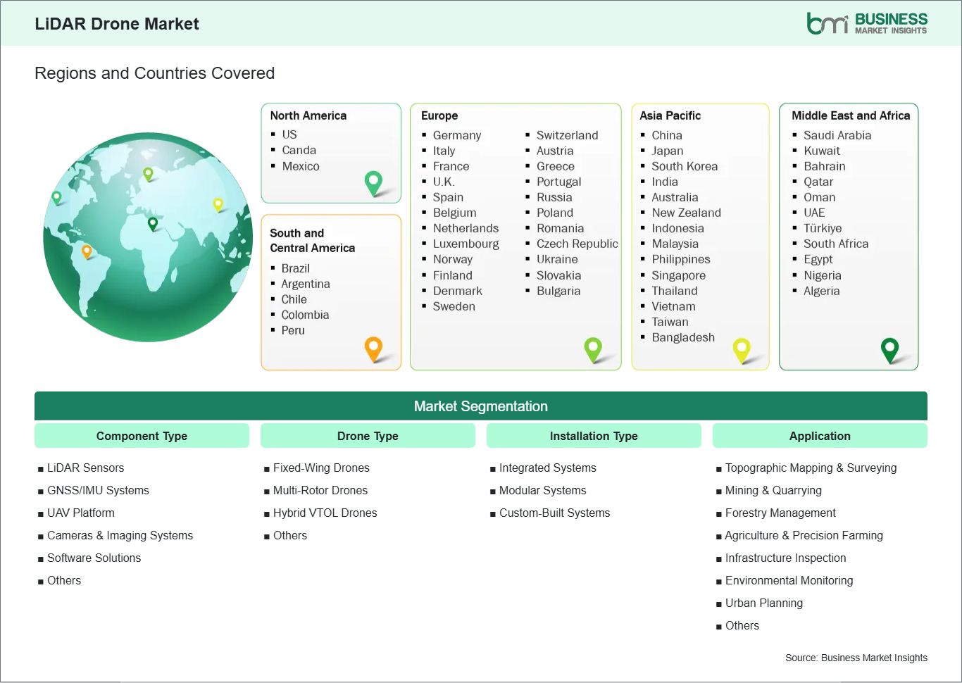
LiDAR Drone Market Segmentation
The LiDAR Drone Market is segmented based on component type, drone type, installation type, application, and end user, reflecting the diverse deployment of UAV-based LiDAR systems for mapping, surveying, and spatial intelligence across multiple industries.
By Component Type
- LiDAR Sensors: Core technology component used for high-precision 3D data capture and mapping
- Navigation & Positioning Systems (GNSS/IMU): Ensures accurate geolocation and flight stability during data collection
- Cameras & Imaging Systems: Used for visual data integration with LiDAR point clouds for enhanced mapping accuracy
- UAV Platforms (Drones): Aerial vehicles that carry LiDAR payloads for data acquisition
- Software Solutions: Includes data processing, point cloud analysis, 3D modeling, and GIS integration tools
- Others: Includes batteries, storage systems, and communication modules.
By Drone Type
- Fixed-Wing Drones: Used for large-area mapping and long-endurance surveying missions
- Multi-Rotor Drones: Widely used for high-precision, short-range surveying and complex terrain mapping
- Hybrid VTOL Drones: Combine vertical takeoff with fixed-wing efficiency for extended operational flexibility
- Others: Includes specialized UAV platforms designed for niche surveying applications.
By Installation Type
- Integrated LiDAR Systems: Fully embedded LiDAR payload systems designed for plug-and-play UAV deployment
- Modular LiDAR Systems: Detachable and interchangeable LiDAR units mounted on different drone platforms
- Custom-Built Systems: Application-specific configurations tailored for defense, mining, and large-scale infrastructure projects.
By Application
- Topographic Mapping & Surveying: High-accuracy terrain modeling for construction, infrastructure, and land development
- Mining & Quarrying: Volume estimation, site monitoring, and resource planning applications
- Forestry Management: Tree height measurement, biomass estimation, and forest density analysis
- Agriculture & Precision Farming: Crop health monitoring, irrigation planning, and yield optimization
- Infrastructure Inspection: Roads, railways, bridges, and power line monitoring
- Environmental Monitoring: Flood mapping, coastal erosion analysis, and disaster management
- Urban Planning & Smart Cities: 3D city modeling and infrastructure planning
- Others: Archaeology, defense mapping, and research applications.
By End User
- Construction & Infrastructure: Used for site planning, earthwork analysis, and project monitoring
- Mining & Natural Resources: Supports exploration, excavation planning, and operational optimization
- Agriculture: Enables precision farming and crop analytics
- Forestry & Environmental Agencies: Used for ecological monitoring and conservation planning
- Oil & Gas: Pipeline inspection and terrain analysis in remote locations
- Defense & Security: Surveillance, terrain mapping, and mission planning
- Government & Municipal Bodies: Urban planning, land surveying, and disaster management
- Others: Includes academic institutions, research organizations, and mapping service provid.